Borovoe (Būrabay)
Burabay (Бурабай көлі, Burabai kölı, Боровое, Borovoye) is a prominent lake of the Kokshetau Lakes, a group of lakes in northern Kazakhstan, located in the Burabay District of Akmola Region, in the eastern part of the Kokshetau Hills.
The name of the lake originates from the word bor, which means "pine forest". The historical name is Auliekol, which means "holy lake".
The lake is separated from nearby lake Ulken Shabakty to the north by a narrow strip of land. Lake Kishi Shabakty lies 5 km to the NW and lake Shchuchye 12 km to the SW. The shores of the lake are overgrown with pine forest. The water in the lake is limpid and the bottom can be seen clearly. The water surface of the lake is almost open, only the western and northwestern shores are rushy; the southern shores are rocky, and the eastern shores are sandy. The bottom is flat.
The lake has several capes. Near the northwestern cape, there is a rocky mushroom-shaped island, Zhumbaktas ("Sphinx"), reaching an elevation of 20 m above the water. Burabay is separated by mountain ranges from the closest lakes. The cliffs and capes of the northwestern and southern coasts create a unique landscape.
The lake water is healing. On the eastern shore, there is the Burabay spa town and the Nature Museum (Kazakh: Табиғат мұражайы). The surrounding area is situated within the Burabay National Park.
Map - Borovoe (Būrabay)
Map
Country - Kazakhstan
 |
 |
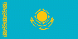
| Flag of Kazakhstan | |
The country dominates Central Asia economically and politically, generating 60 percent of the region's GDP, primarily through its oil and gas industry; it also has vast mineral resources. Officially, it is a democratic, secular, unitary, constitutional republic with a diverse cultural heritage, and has the highest Human Development Index ranking in the region. Kazakhstan is a member state of the United Nations, World Trade Organization, Commonwealth of Independent States, Shanghai Cooperation Organisation, Eurasian Economic Union, Collective Security Treaty Organization, Organization for Security and Cooperation in Europe, Organization of Islamic Cooperation, Organization of Turkic States, and International Organization of Turkic Culture.
Currency / Language
| ISO | Currency | Symbol | Significant figures |
|---|---|---|---|
| KZT | Kazakhstani tenge | ₸ | 2 |
| ISO | Language |
|---|---|
| KK | Kazakh language |
| RU | Russian language |


